
For Buyers
5 min read
Site constraints: Don’t let these torpedo your development
Welcome back to our next article in the essential Due Diligence for Developers series, where we are taking a closer look at site constraints. In case you missed it - check out our previous article on flood zones, here.
Site constraints are the physical features that can either limit (or outright block) your development plans. While many are visible and not at all unusual, their impact is often not understood properly until it's too late. Don't become a victim of this 'hiding in plain sight' feature, think about the potential problems at the beginning, and save yourself issues later on.
Site constraints include features like:
While they are everyday features to which most wouldn't even blink an eye, they can determine whether your site is feasible and potentially cause major headaches further down the path.
Let's take a closer look at a couple of the main constraints you may face:
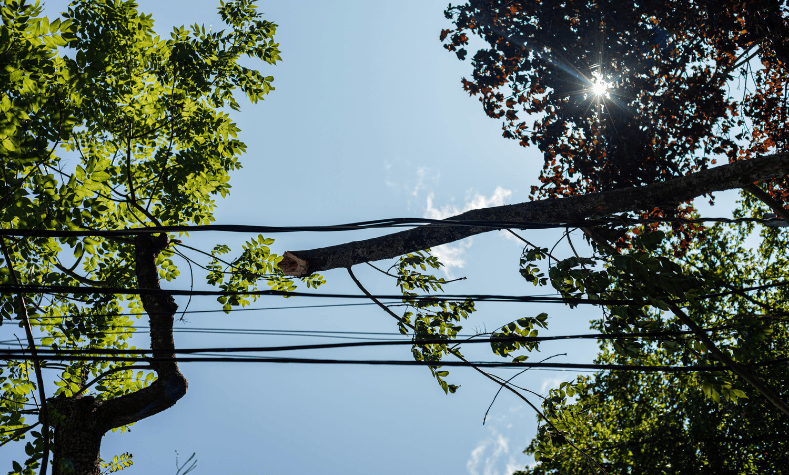
Power lines: transmission lines (check out this map) have setback requirements based on voltage. Even low-voltage lines may require setbacks of several metres which can cut into your yield, or even make certain building types unviable.
Street trees: these may look removable…but often aren't. If they sit on public land and you're given a no from parks to removal, you have no right of appeal.
Streams and coastal margins: a stream more than 3 metres wide often triggers a 20-metre esplanade reserve on each side, meaning 43 metres of land could be lost to council without compensation.
Access issues: bus stops, red no-parking zones, and intersection proximity can all limit your ability to gain vehicle access. That's not just inconvenient, it can block resource consent.
![Satellite View of Suburb in New Zealand from Relab]()
As Campbell Brown Planning advises: "It's about understanding the context of the site because those things could even be outside the Auckland Council resource consent team's control." Don't let one tree or power pole derail your project. Check constraints early, before you lock in a site.
Stay tuned for the next article in our series: Hidden costs and planning changes: What to watch for, and get in touch with the team with any questions you may have, we'd love to support you.
Site constraints are the physical features that can either limit (or outright block) your development plans. While many are visible and not at all unusual, their impact is often not understood properly until it's too late. Don't become a victim of this 'hiding in plain sight' feature, think about the potential problems at the beginning, and save yourself issues later on.
What are site constraints?
Site constraints include features like:
- Power lines
- Trees on the street
- Streams and wetlands
- Sloping topography
- Vehicle access restrictions
While they are everyday features to which most wouldn't even blink an eye, they can determine whether your site is feasible and potentially cause major headaches further down the path.
Top constraint offenders
Let's take a closer look at a couple of the main constraints you may face:
Power lines: transmission lines (check out this map) have setback requirements based on voltage. Even low-voltage lines may require setbacks of several metres which can cut into your yield, or even make certain building types unviable.
Street trees: these may look removable…but often aren't. If they sit on public land and you're given a no from parks to removal, you have no right of appeal.
Streams and coastal margins: a stream more than 3 metres wide often triggers a 20-metre esplanade reserve on each side, meaning 43 metres of land could be lost to council without compensation.
Access issues: bus stops, red no-parking zones, and intersection proximity can all limit your ability to gain vehicle access. That's not just inconvenient, it can block resource consent.
What you can do
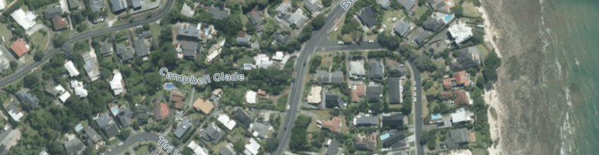
- Use Relab for a smart solution - the 'street view', 'contour map' and 'satellite map' are all integrated so you can quickly scan for potential site constraints before you shortlist the property
- Walk the site and note visible constraints (trees, poles, driveways)
- Use council maps to confirm public assets or protections
- Bring in a planner, arborist or traffic consultant early if you spot concerns
- Have a plan B for any potential issues
As Campbell Brown Planning advises: "It's about understanding the context of the site because those things could even be outside the Auckland Council resource consent team's control." Don't let one tree or power pole derail your project. Check constraints early, before you lock in a site.
Stay tuned for the next article in our series: Hidden costs and planning changes: What to watch for, and get in touch with the team with any questions you may have, we'd love to support you.