
For Buyers
5 min read
Natural hazards: What flood zones really mean
Welcome back to our next article in the essential Due Diligence for Developers series, where we are taking a closer look at flood zones. In case you missed it - check out article one on zoning, here.
Auckland's recent floods have changed the game. For developers, it's no longer enough to just know whether a site is in a floodplain, you need to understand how that affects what you can build, and how you'll prove it won't increase risk.
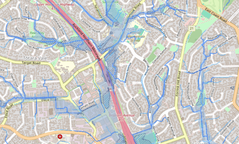
Natural hazard overlays - particularly floodplains and overland flow paths - are now a serious focus for Auckland Council. Following the anniversary weekend floods in 2023, developers must now demonstrate that their designs protect future occupants and won't worsen flooding for neighbours. And here's the key: even if a site's flood overlay looks minor, it can trigger significant design changes, extra consultant reports, or in the worst case, make a project unfeasible.
![Screenshot of Floodplains on Relab]()
As planner Michael Campbell notes: "If the site's sitting at the top of the catchment and the floodplain is relatively small, it may not be an issue. But if you're at the bottom, it could be fatal to your aspirations for the site."
If flood risk exists, the council expects you to mitigate it. This could involve:
![Screenshot of contours on relab]()
A good planner or engineer can help determine whether flood constraints are minor, manageable, or a deal-breaker. Don't leave it to chance!
Stay tuned for the next article in our series: Site constraints: Don't let these torpedo your development, and get in touch with the team with any questions you may have, we'd love to support you.
Auckland's recent floods have changed the game. For developers, it's no longer enough to just know whether a site is in a floodplain, you need to understand how that affects what you can build, and how you'll prove it won't increase risk.
Why it matters
Natural hazard overlays - particularly floodplains and overland flow paths - are now a serious focus for Auckland Council. Following the anniversary weekend floods in 2023, developers must now demonstrate that their designs protect future occupants and won't worsen flooding for neighbours. And here's the key: even if a site's flood overlay looks minor, it can trigger significant design changes, extra consultant reports, or in the worst case, make a project unfeasible.
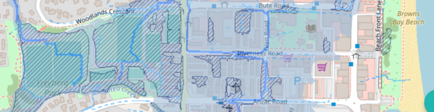
What you need to check
- Relab: first point of call for saving you time - including checking for flood plains: these show the 1-in-100-year flood extent
- Overland flow paths: even narrow flow paths matter, especially where they intersect with building platforms
- Catchment position: sites downstream carry more risk than those at the top
As planner Michael Campbell notes: "If the site's sitting at the top of the catchment and the floodplain is relatively small, it may not be an issue. But if you're at the bottom, it could be fatal to your aspirations for the site."
What council expects
If flood risk exists, the council expects you to mitigate it. This could involve:
- Raising finished floor levels
- Ensuring evacuation paths remain clear
- Designing buildings that preserve flood storage
- Proving minimal upstream/downstream impacts
Further actions to take
- Check out Relab's new podcast and blog where we dig deeper into GeoMaps to check whether your property is flood prone
- Use Auckland GeoMaps to identify more indepth information on flooding hazard overlays
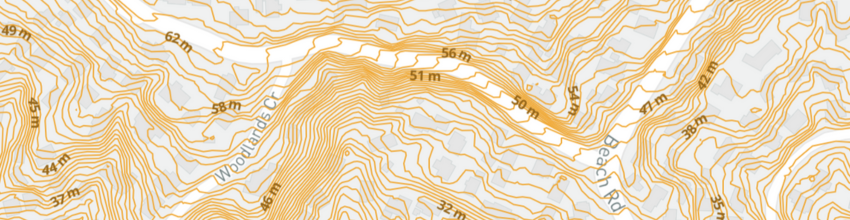
- Use Relab to review flood risk alongside infrastructure capacity (stormwater outlets, discharge points, contours)
- Budget for engineering input early, as you'll likely need a civil engineer to model flooding impacts and suggest mitigation, these aren't small tweaks and they can reshape your whole development layout
A good planner or engineer can help determine whether flood constraints are minor, manageable, or a deal-breaker. Don't leave it to chance!
Stay tuned for the next article in our series: Site constraints: Don't let these torpedo your development, and get in touch with the team with any questions you may have, we'd love to support you.