
For Buyers
5 min read
Infrastructure: Assumptions that can cost you
Welcome back to our next article in the essential Due Diligence for Developers series, where we are now taking a closer look at making costly infrastructure assumptions. In case you missed it - check out our previous article on hidden costs and planning changes, here.
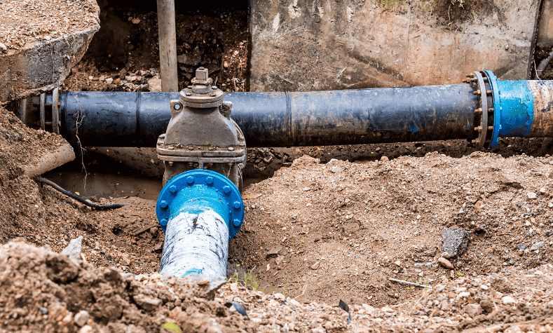
When you see pipes in the street (think stormwater, wastewater, water supply) it's easy to assume you're good to go, but that assumption can derail your entire project. The reality is, just because infrastructure exists doesn't mean you can necessarily use it. And if you don't confirm capacity and connection early, you might face delays, redesigns…or even a total stall.
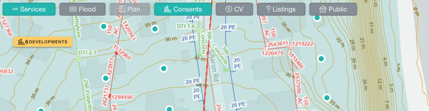
![Screenshot of Services and Consents overlay on contour view on Relab]()
Many urban Auckland sites are already developed or partially serviced, so it's tempting to think connections are a given. But planners and engineers will tell you otherwise: capacity isn't guaranteed. As Michael Campbell of Campbell Brown Planning explains:
"Just because a site has visible servicing doesn't necessarily mean you can access the line. There may be capacity issues… That could delay you for months or years."
Use historic aerials (available via GIS) to check for former orchards, mechanics, or commercial activity, as these can raise contamination risks and trigger specialist reports, for example areas like Whenuapai and West Auckland are common hotspots.
Stay tuned for our next article in the due diligence series on The paper trail - LIMs, titles and property files, and get in touch with the team with any questions you may have, we'd love to support you. Remember: Relab is the go-to industry platform, so save yourself valuable time and give Relab a try - we offer a 14 day free trial so you can experience the full value of what we can offer.
When you see pipes in the street (think stormwater, wastewater, water supply) it's easy to assume you're good to go, but that assumption can derail your entire project. The reality is, just because infrastructure exists doesn't mean you can necessarily use it. And if you don't confirm capacity and connection early, you might face delays, redesigns…or even a total stall.
Why infrastructure assumptions are risky
Many urban Auckland sites are already developed or partially serviced, so it's tempting to think connections are a given. But planners and engineers will tell you otherwise: capacity isn't guaranteed. As Michael Campbell of Campbell Brown Planning explains:
"Just because a site has visible servicing doesn't necessarily mean you can access the line. There may be capacity issues… That could delay you for months or years."
What you need to check
- First stop: Relab's due diligence and mapping services
- Location of services: start by identifying what's there, use Auckland Council's GeoMaps to check for stormwater, wastewater and water lines
- Access and connection feasibility: just because a pipe runs nearby doesn't mean you can legally or practically connect, for example servicing might be on the wrong side of the road, at the wrong grade, or fully allocated to existing properties
- Actual capacity: this is the biggest catch…even if a pipe runs past your boundary, it may not have capacity for new dwellings, especially in areas under growth pressure
- Request a capacity check early from Watercare for wastewater and water supply questions
- Contact a civil engineer to assess stormwater design, overland flow management, and infrastructure connection feasibility
Historic use can also flag issues
Use historic aerials (available via GIS) to check for former orchards, mechanics, or commercial activity, as these can raise contamination risks and trigger specialist reports, for example areas like Whenuapai and West Auckland are common hotspots.
What's next?
- Start with a quick scan on Relab to check for development constraints and shortlist properties worth investigating
- Use GIS and aerial photos for infrastructure and historic use
- Get a civil engineer's input early before you go unconditional
- Contact Watercare for capacity checks, not just mapping
Stay tuned for our next article in the due diligence series on The paper trail - LIMs, titles and property files, and get in touch with the team with any questions you may have, we'd love to support you. Remember: Relab is the go-to industry platform, so save yourself valuable time and give Relab a try - we offer a 14 day free trial so you can experience the full value of what we can offer.