

For Agents
4 min read
Estimate civil costs before you buy land
Get services, contours, and site data in one view to rapidly assess development costs
Book a Demo →
Stop switching between tools during initial site assessment
Scattered Information
Jumping between Council GIS, listing sites, and satellite data wastes valuable time during site assessment.
Incomplete View
Critical information about services, Watercare capacity, contours and neighbouring consents is spread across multiple platforms, making quick decisions difficult.
Risk of Oversight
Without a complete picture, you might miss crucial civil service constraints that impact development costs.
All critical site data in one view
Make informed decisions faster with consolidated early-stage site information
Services Overlay
- View stormwater and wastewater connections
- Check pipe diameters and depths
- See Watercare network capacity constraints
Contour Map
- See detailed topography
- Measure site gradients
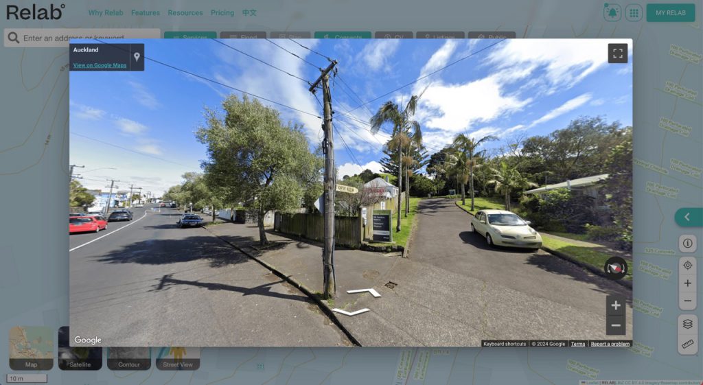
Google Street-View
- Check site access and street conditions
- View neighbouring properties
- Check overhead power lines
Measurement Tools
- Calculate distances to services
- Measure site boundaries
- Determine total areas
Speed up your initial site assessment process
Reduce Risk
- Identify service challenges before purchase
- Understand site constraints upfront
- Make informed land acquisition decisions
- Prevent costly surprises
Save Time
- Access all data in one platform
- Find services instantly
- Measure distances quickly
- Stop switching between tools
Control Costs
- Prevent unexpected civil costs
- Make faster go/no-go decisions
- Factor services into early feasibility
Frequently Asked Questions
- How current is your services data?
- Our data is updated weekly through our partnerships with local councils and Watercare.
- Which development features are available in my region?
- Services Overlay (stormwater & wastewater): Available in Auckland, Christchurch, Waikato, and Queenstown.
- Building & Resource Consents: Available in Auckland, Christchurch, Waikato & Wellington.
- Contour Map: Available in Auckland, Waikato, and Queenstown
- Street View and Satellite imagery: Available nationwide
- Watercare network capacity constraints: Available in Auckland.
- What support do you provide?
- We offer full training and ongoing support to help you make the most of the platform.
Ready to Transform Your Site Assessment Process?
Join leading developers who are already using Relab to speed up their site assessment process.
Book Your Demo Today